GIS and QGIS
A quick view on the menus in QGIS
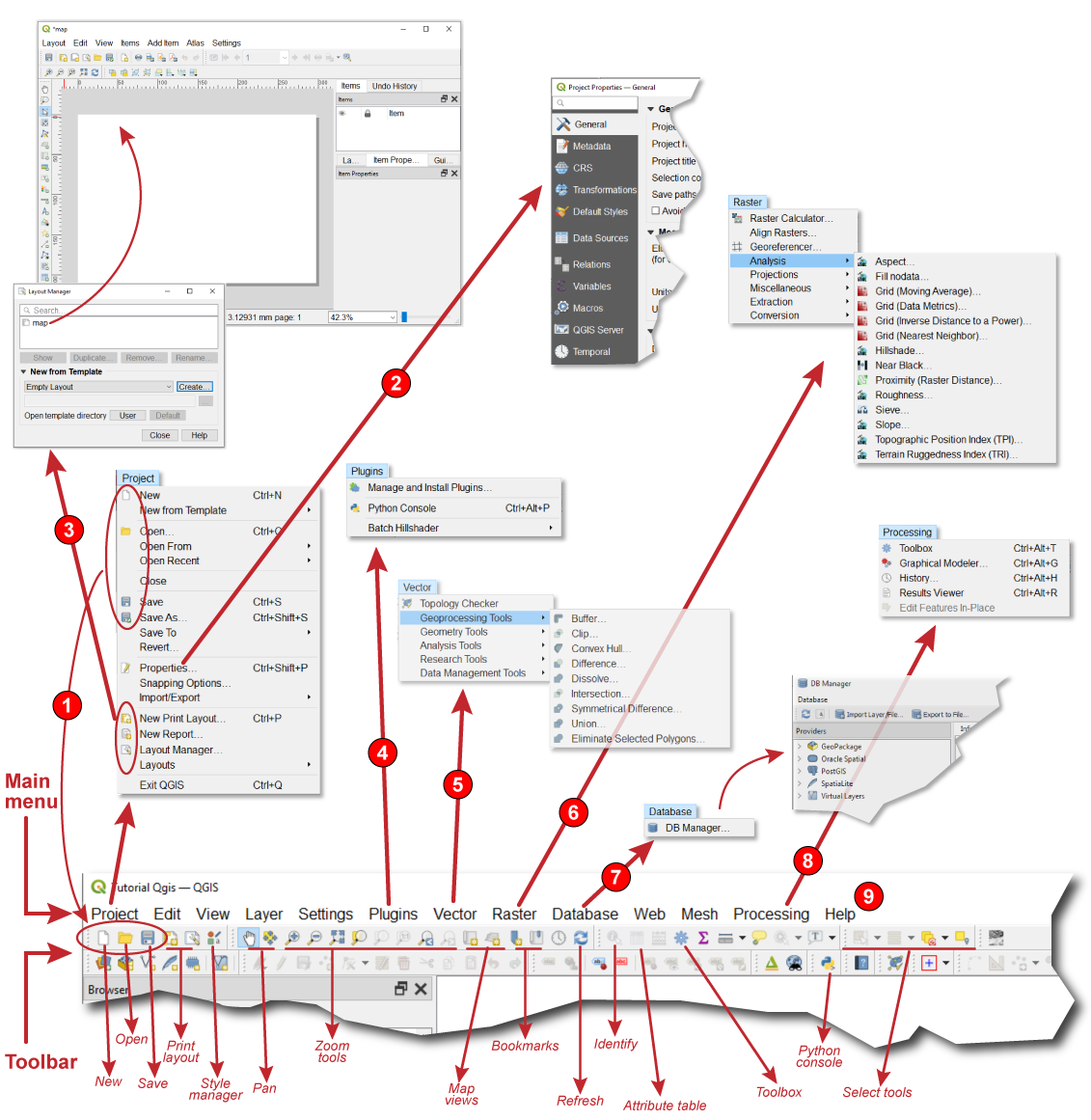
The Main Menu and the indicated tools on the Toolbar are the two most frequently used means to trigger actions. Both menus are connected in a way, in many cases they give access to same actions. This can be clearly identified on the used icons in both. The icons in front of the "New...", "Open..." and "Save..." menu items in the [Project] menu are also used in the Standard toolbar
The properties
Through the "Layout"
The [Vector] and [Raster]
The [Database] manager
The DB Manager Plugin is officially part of the QGIS core and is intended to be the main tool to integrate and manage spatial database formats supported by QGIS (PostGIS, SpatiaLite, Geopackage, Oracle Spatial, Virtual layers) in one user interface. The dbManager DB Manager Plugin provides several features. You can drag layers from the QGIS Browser into the DB Manager, and it will import your layer into your spatial database. You can drag and drop tables between spatial databases and they will get imported.
QGIS docs
To get access to the "Toolbox" or "Graphic Modeler", the [Processing]
The [Help] menu
The menu bar provides access to various QGIS features using a standard hierarchical menu. The top-level menus and a summary of some of the menu options are listed below, together with the associated icons as they appear on the toolbar, and keyboard shortcuts. The shortcuts presented in this section are the defaults; however, keyboard shortcuts can also be configured manually...
...Although most menu options have a corresponding tool and vice-versa, the menus are not organized exactly like the toolbars. The toolbar containing the tool is listed after each menu option as a checkbox entry. Some menu options only appear if the corresponding plugin is loaded.
You'll work with different types of commands:
- Buttons execute a specific task when you click them.
- Tools are similar to buttons except they allow you to interact with the display before an action is performed. For example, the Zoom In tool allows you to drag a rectangle over a map to specify the new extent.
- A tool palette presents a collection of related tools.
- Combo boxes allow you to choose an option from a drop-down list.
- Text boxes or edit boxes allow you to type in text.
- Menus present a list of commands. A context menu is a floating menu that pops up at the location of the pointer when you right-click.